
Think you just felt an earthquake? Know for sure that you did? Check out one of the resources below for up-to-the-minute info on temblors that make you tremble.
◊
Did you feel something shake just now, or in the recent past? Earthquake maps are excellent tools to help understand where earthquakes are happening today and to picture the fault lines all around the world where they are likely to occur.
These sites offer a variety of ways to hunt for earthquake activity, both today’s and recent tremors. Some are region-specific (hint: California looms large as a particularly active region), and others cover the entire globe. Here are five of the top sites for viewers looking for the latest info:
IRIS is an acronym that stands for Incorporated Research Institutions for Seismology, a consortium of more than 120 United States universities “dedicated to the operation of science facilities for the acquisition, management, and distribution of seismological data.” This monitor takes a worldwide view and shows active and recent quake activity labeled with different colored circles. It also offers “zoom maps” that allow you to see individual continents and other hot spots.
2. The Berkeley Seismology Lab of the University of California, Berkeley
This site focuses on California and Nevada, with squares of different colors and sizes to mark time and intensity. Clicking on a square brings up specific information about the event it represents, whether it’s happening now or earlier. You can also zoom out within the map to see broader geographic areas.
3. The Southern California Earthquake Data Center
The Data Center is a project of the well-respected Seismological Laboratory at Caltech. It offers extensive data on the quakes that it follows, and, like the Berkeley map, it is centered on California and Nevada but without the option of viewing a larger area.
4. QUAKES Live Earthquakes Map
QUAKES is a commercial service operated with input provided by data “imported from various governments.” It presents a map of the Earth on which are overlaid circles of various sizes that represent significant earthquakes of today and the recent past. Hovering over a circle reveals a variety of information about the quake, such as time, location, and magnitude.
5. The U.S. Geological Survey (USGS)
The USGS map is perhaps the most flexible and useful of all maps generally available to the public. Its preset is for earthquakes of the last day, magnitude 2.5 and greater, within the United States. However, it’s easy to change the preset to seek out information on earlier earthquakes, smaller quakes, and quakes in any other part of the world. There’s even a handy preset zoom that takes you to a map of the world with plate tectonics noted for easy reference. Clicking on an orange circle leads to a pop-up link that reveals very detailed information on the quake, the region where the quake occurred, and a full-color interactive map with more information.
Ω
Kevin Martin is Senior Writer for MagellanTV. He writes on a wide variety of topics, including outer space, the fine arts, and modern history. He has had a long career as a journalist and communications specialist with both nonprofit and for-profit organizations. He resides in Glendale, California.
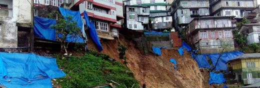
Title image: The Great Hanshin-Awaji Earthquake via Wikimedia Commons.